Historic Preservation in Newtown
The historic preservation movement in the United States had its official beginning in 1966 with the passage of the National Historic Preservation Act. One of the significant outcomes of the program has been to encourage towns and cities across the country to develop projects to recognize and protect historic sites.
As a result, historic preservation programs in local communities helped to increase property values in historic districts at a greater rate than neighborhoods that are not historically designated. This is demonstrated throughout Florida and is documented by a study, “The Economic Impacts of Historic Preservation in Florida,” commissioned by the Florida Department of State.
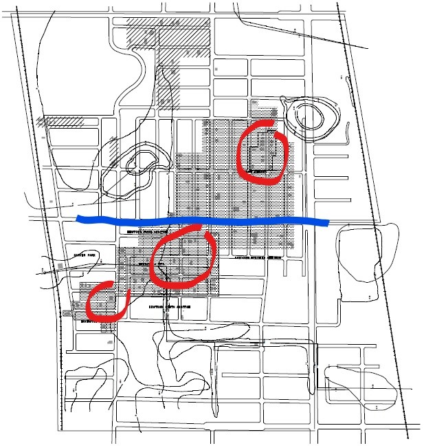
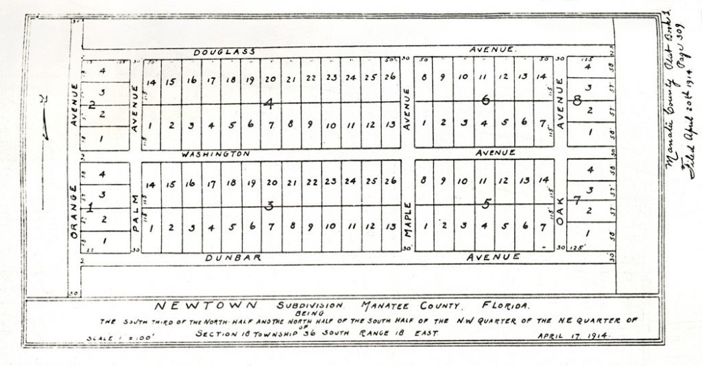
One objective of the Newtown Conservation Historic District project was to identify buildings that contributed to the character and history of the African American community. The process began by analyzing how the neighborhood developed. Maps, city directories, the U.S. Census and other historic documents were examined.
A visual survey of each building in the entire neighborhood was conducted to determine the structures that would potentially meet the criteria for historic designation. Approximately 150 sites were identified. Additional research helped to pinpoint an approximate date of construction and an architectural style.
The mapping process clearly revealed two concentrations of potentially historic sites that would qualify for historic districts, one located within the Newtown plat, the first area of the Newtown neighborhood to be developed. The other is located in another early development area in the Newtown Heights plat.
The study of maps, land surveys, and aerial photography reveal interesting patterns of growth throughout the Newtown area. The boundaries of the study area are defined as follows:
North – Myrtle Avenue
South – 17th Street
East and West – Railroad tracks
Within the area, surveyed building lot tracts began in 1914 with significant growth in the 1920s and late 1940s. Lots were generally 100 feet long and 50 feet wide with unpaved streets.
Subdivisions and Building Lot Plats
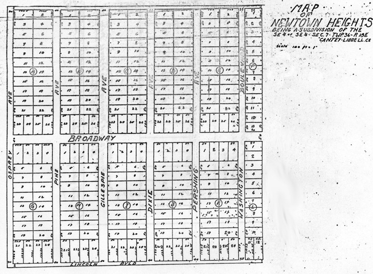
Newtown Heights – 1925
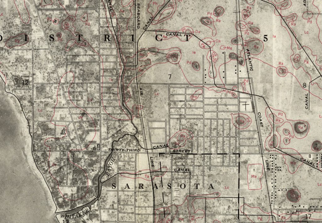
Soil Survey, 1959, showing land types, drainage with street overlay.
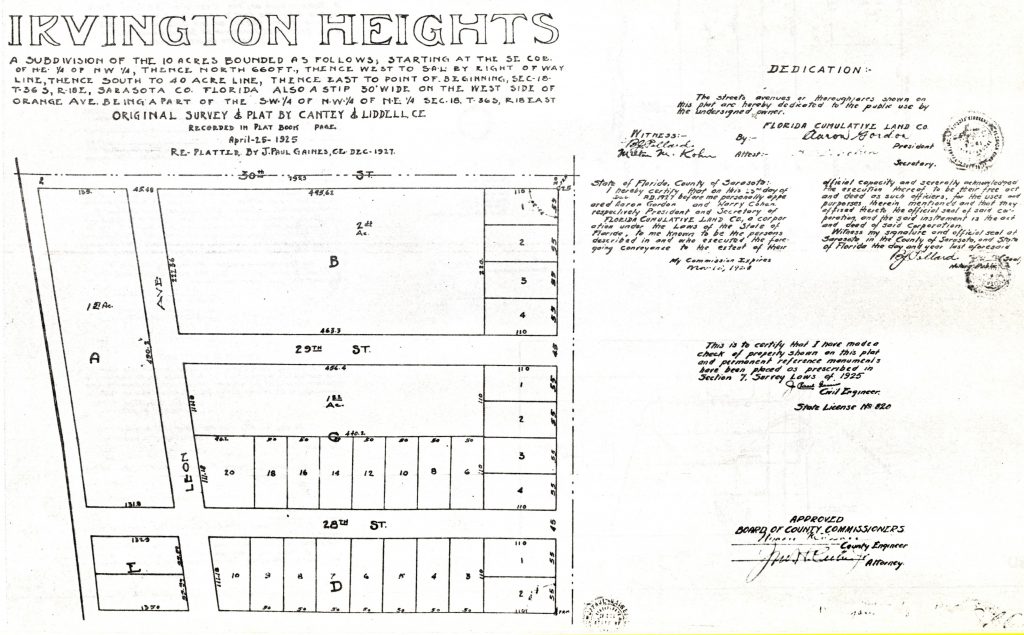
Irvington Heights – 1925
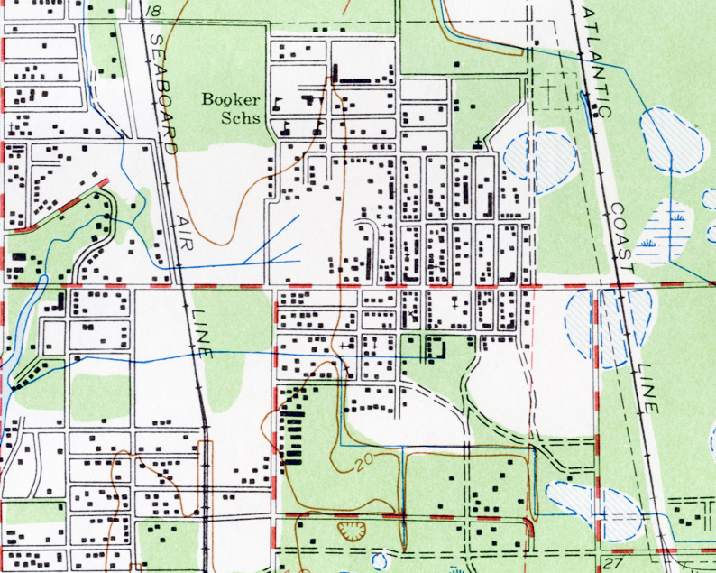
TopographicMap_NewtownCrop-1_1973.jpg
The study of maps, land surveys, and aerial photography reveal interesting patterns of growth throughout the Newtown area. Combined with the locations of historic structures, map overlays reveal four distinct cultural zones (two potential historic districts) which show one larger area defined by land not prone to flooding. This reveals a picture of the way of life in the Newtown area: how people lived and traveled in and out of the area, where they gathered and established businesses, and how the community grew and changed over time.

